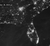
The storm path was about 70 miles east of me. I literally feel guilty about praying that the storm, which was predicted at landfall to track directy over us, would move further east. Those folks, from the landfall in Florida, through east Georgia and on up into the Carolinas, are still suffering. This NASA picture illustrates the power outages. That bright spot at the top is Atlanta, of course.