Legality of using phone maps instead of GPS

I’m not too worried about data usage on maps. I have had this discussion before but maps does not appear to use use cellular data. It works of the worldwide GPS system. I get full maps coverage where I have no cell coverage at all for an hours driving in any direction.

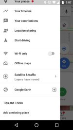
Not sure what app you are using, but Google maps does use cellular data to download the maps as you travel. This is why I recommended finding out how to download the maps ahead of time to avoid issues where there is no data connection. Of course your position is determined by the GPS satellites without using data, but the map itself showing roads, towns, gas stations, etc., etc. requires data to download as you go along unless they have been downloaded ahead of time to your device.

There are some apps that use previously downloaded maps, so you could be using one of those. I have used MapFactor GPS Free (Android app, not sure if it's available on ios). The user interface is a bit odd, but once you get used to it it does work. You download maps by state ahead of time, and the app uses no data during navigation.
 
Last edited:
Google Maps will work without cell service when the maps are downloaded to your phone. Offline Maps is the area of the app where you manage this.
 

Attachments

  • Screenshot_20180722-170736.jpg
    Screenshot_20180722-170736.jpg
    21.9 KB · Views: 9
...

Be aware, though, that there are many areas in the western US where there is no cell coverage from any carrier. It's not cost effective for them to set up towers in vast sparsely populated areas. You'll have coverage in cities and along Interstates, but some other places you won't. Your best bet is to download maps for the areas you'll be traveling through ahead of time, perhaps using your hotel's wifi the night before to avoid data charges. Then you don't need data to navigate the next day. Rather than go into detail on how to do that, I will just point you to Google.


One reason I use a Garmin rather than cell phone - for navigation.
 
Was also thinking Rental with GPS.
Cell Coverage- can be spotty out West.
Verizon has the best coverage, it’s usually the most expensive.
Gas Rule - when leaving a larger town, always leave with tank full of gas.
There may or not be gas down the line.
And if there is, it’s almost always more expensive.
 
But it will upset my wife a bit. She has her favourite radio stations she likes to listen too and would like to be able to stream them constantly while we are driving to keep up with things at home. I can use the “no cell service” argument to play my saved music though :D:D:D

Any rental car you get here will have satellite radio. You'll be fine . . .
 
I use a mount that clips into the center dash vent. It hold smart phones and GPS Units! It ends up being below the bottom of the windshield (windscreen) and has no obstruction. The cord to the electric port (cigarette lighter) is a pain, but you don't want a dead phone battery when your trying to not be lost! Funny as it seems "Band-Aids" are great for temporary wire restraining!

It may be just my phone (an old Samsung S4) but when I am using Google Maps for navigation with GPS, it consumes power faster than it is supplied by the USB cord. So even if I start with a battery that is charged 100%, eventually it will get drained and turn itself off even though it's getting power from the car! A full charge will get me something like 6 hours of navigation. Consequently I try to turn off Maps when we're stopped for a break if we're on a long trip.

One other thing about Google Maps is that it uses real-time traffic data to alert you of slowdowns and traffic jams. This can sometimes be handy, or not depending on the situation. If there is a "faster" route available it may ask if you want to re-route, but the benefit may only be a minute or two, and the detour more stressful than just waiting in traffic.

Likewise, on my phone Google Maps will usually show you the "fastest" route, not necessarily the easiest. We have friends who live in Missouri. The route recommended by Google is 195 miles and takes 3 hours and 26 minutes. The route I prefer is 211 miles and takes 3 hours and 30 minutes, but is a hell of a lot easier to drive because the last hour is not a bunch of twisty back roads like the first route. Something to watch out for.
 
Back
Top