WE'VE DONE AS MUCH AS WE CAN FOR HURRICANE MILTON SLOWLY APPROACHING - NERVE RACKING!

We’re staying. Never evacuated for a hurricane in 60+ years, not going to now.

Thanks for saying that Tom, hope you and yours get through OK. I tried to get my wife to fly to Indiana but she won't leave me. No more flights anyway and OIA is closing early tomorrow. Problem is I can do for me no matter what, "us" is different. We'll know in 48 hours. Joe
 
Chief, based on some of your post I thought you were in Naples? If so the brunt of it should go north of you.
 
A few years ago we saw this home on Sullivan’s Island right outside Charleston. Allegedly could take a CAT5.


The Dome Houses of Marco Island get taken out by IAN. They stood for a very long time. I want to say 50+ years.
 

Attachments

  • P4092819.jpg
    P4092819.jpg
    41.1 KB · Views: 58
I went down to my moms winter house in Ormond Beach and installed all 10 of her hurricane panels. She won't be coming down for the winter till last of the month.

I filled a few gas cans for me, I'm still waiting to see if I need to put my hurricane panels up.

Coming back home today from the US1 exit at Destination Daytona to the Palm Coast Parkway exit...16 miles. I counted 187 power line trucks heading southbound on 95.
 
John D McDonald, author of the Travis McGee crime novels, also wrote a serious novel entitled "Condominium." In it he mentions how much of the Florida coast, especially the Gulf side, is built on landfill. He argued that eventually the sea will want that area all back again. Pray he didn't know what he was writing about.
 
Found this webpage regarding the dangers in the Tampa area. NWS Southern Region Tropical Webpage

My FL geography may be a bit off, but it looks to me that the storm surge will be ugly from Naples all the way to Tampa/St Pete.

attachment.php


It is also worth looking at the rain flooding potential.

attachment.php
 

Attachments

  • PredictedSurge1008.jpg
    PredictedSurge1008.jpg
    214.6 KB · Views: 205
  • PredictedFlooding1008.jpg
    PredictedFlooding1008.jpg
    191.5 KB · Views: 207
1045 PDT, the Key West weather radar is showing the eye of Milton at extreme range, say 225 miles. That puts the cloud tops the radar can see at 35k ft at least.
 
It's gonna get UGLY here in about 8 hours. At 9am on Wednesday we are just getting a "mild" pleasant wind (10 - 12 mph). Unfortunately for us the main part of the storm will arrive after dark - I HATE that. At least I'd like to be able to see what is happening.
 
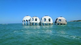
We took our last load of yard debris from H. Helene to the dump yesterday. Had to wait an hour in line to get in! We've done all the laundry, ran the dishwasher, filled the gas cans, and our pantry is full. I don't worry as much about the wind as about dealing with the power outages, which we expect later tonight or early Thursday when the worst hits us. We live just south of the Orlando metro area and predictions are it will still be a Cat-1 when it passes over us - until this last update the pathway passed literally right over our house!

I've lived here in Central Florida since 1975 with a few years off for good behavior to attend college and have been through many storms. Someone once asked me "What does a hurricane sound like?" My answer is there are three distinct sounds that I equate with a storm like this:

1. (Before) The frequent Emergency Alert Tones for winds, flooding, tornados, etc. After the first 40 or 50 from your cellphone, radio, TV, etc. (even the Amazon Echo devices we have) I am hunting through the settings to turn them off!
2. (During) The constant background howling of high winds. It's pervasive, like a freight train that takes half a day to pass by.
3. (After) The sound of generators...
 
My brother will be heading to my Mom's to ride the storm out. Very little prep needed, lawn chairs and sliding shutters to secure and a brace for the garage door. Her whole house Generac is serviced regularly.
Milton appears to have been moving slower than expected and NWS forecast wind impacts peak around 0800 Thurs. as the storm passes 35 miles north of her.
 
Gotta love your Gov, plain speaking right now with updates and valuable info.

Just saw the Pinellas county emergency coordinator on TV. She said flat out that staying and 'riding it out' on the coast in her area 'is not survivable'. Doesn't come any plainer than that.
 
Just saw the Pinellas county emergency coordinator on TV. She said flat out that staying and 'riding it out' on the coast in her area 'is not survivable'. Doesn't come any plainer than that.

These are the quotes I hate. They are usually made by the media like the weather channel. She could have said dangerous, ill advised, risky……. But NO she went with unsurvivable. So if you stay. You will die?!?!?!?!?! Good grief.
 
These are the quotes I hate. They are usually made by the media like the weather channel. She could have said dangerous, ill advised, risky……. But NO she went with unsurvivable. So if you stay. You will die?!?!?!?!?! Good grief.

As I saw, they were referring to the islands and low areas just off the coast. It's hard to say anything less than "unsurviveable" when the average height above sea level is 2-4 feet with a 8-12 foot storm surge expected.

Besides, if you don't color things like this in the most dire of languages there are far too many folks who will always believe it's not so bad or won't happen to them. During Helene, one county Sherriff announced quite frankly to any who were going to ride it out to take a sharpie and write their info on an arm or leg so they could be identified later. I very much support his position.
 
Back
Top